
By Roy Chung and Quincy Winkler
Introduction
Georgia Tech’s Campus is large and learning how to navigate it can be a daunting task for new students. If a new student needs help finding their way somewhere, an upperclassman may try to direct them with terms like “east campus,” “west campus,” or “around tech green.” But these terms are just as unknown to this new student as the building or area he needs to find. The key to students learning their way around campus is getting an idea for how it’s laid out as a whole rather than just the path to his individual classes. That way, they can get a feel for campus and feel more at home knowing how to get around in confidence. This guide aims to help students build that bigger picture understanding of Georgia Tech campus so they can move from place to place with less confusion and more confidence.
Table of Contents
- Introduction
- Table of Contents
- The Big Picture: Campus Regions
- Tech Green as The Campus Anchor
- Understanding East Campus
- Understanding West Campus
- Key Landmarks To Remember
- Choosing The Right Navigation Tool
- Daily Navigation Habits
Step 1: The Big Picture – Campus Regions
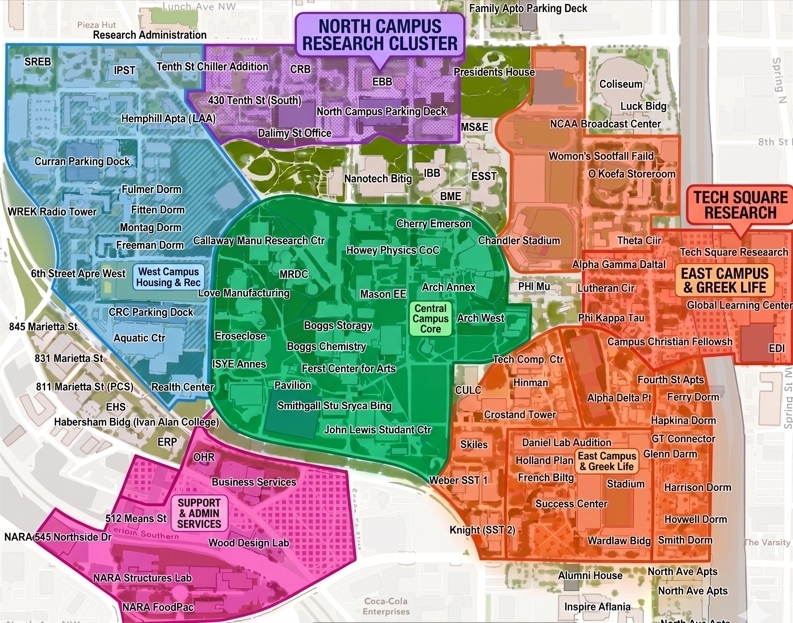
Before trying to simply memorize individual buildings, it’s important to first understand Georgia Tech’s campus as a whole and the different regions campus is made up of. The main areas to understand are Tech Green (the central quad of campus), East Campus, West Campus, and Tech Square. Understanding the layout and different regions can help you group locations together based on where they are rather than thinking of campus as a confusing collection of buildings.
Step 2: Tech Green as The Campus Anchor
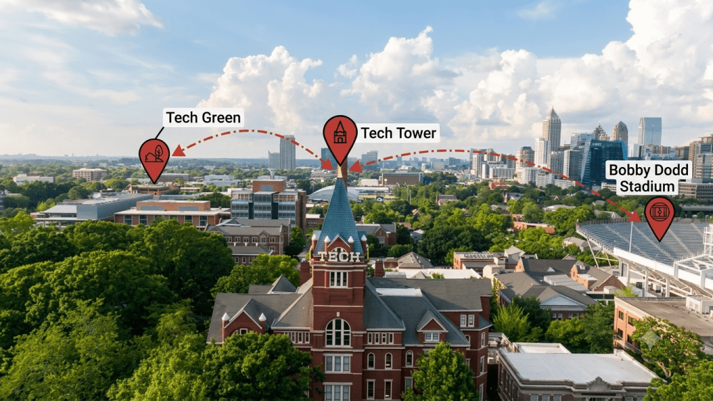
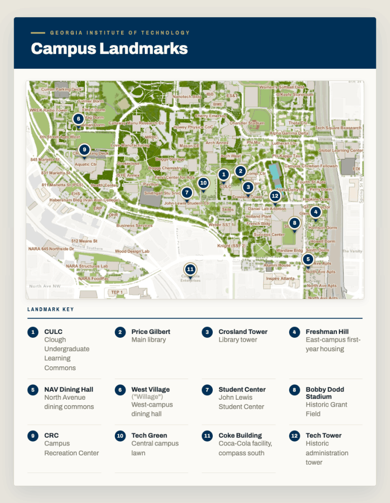
Tech Green sits at the heart of Georgia Tech’s campus, serving as a central gathering space where students relax, study outdoors, and enjoy events. Bordering the Green is the Student Center, with different dining options, student organization offices, and plenty of spaces to hang out between classes. Nearby, the Library, serves as a key study and academic resource. The Library is made up of three buildings: the Clough Undergraduate Learning Commons (CULC), the Price Gilbert Memorial Library, and Crossland Tower. North of CULC is Koan Plaza, a lawn featuring a 40-foot sculpture designed by the late John Portman, a renowned architect and Georgia Tech alumnus. The area also includes Ferst Center for the Arts, a venue that brings theater, dance, and musical performances.
Step 3: Understanding East Campus
East Campus is the more lively, social side of campus, home to all Greek life and athletic stadiums. Residents here dine primarily at North Avenue (NAV) Dining Hall, which sits on the southern border of campus despite its name. Freshman Hill connects the east campus dorms to the library and Tech Green, serving as a daily uphill commute for many first-years and the finish line for the annual Freshman Cake Race. Just across the 5th Street Bridge lies Tech Square, a hub of research buildings, casual dining spots, and the Scheller College of Business.
Step 4: Understanding West Campus
West Campus offers a quieter, more residential feel compared to its eastern counterpart. Your primary dining option here is West Village Dining Hall, affectionately known by students as “Willage.” Also on this side is the Campus Recreation Center (CRC), a go-to spot for working out, swimming, and unwinding after class. Stamps Health Services, the university’s primary medical and wellness facility, sits nearby as well.
Step 5: Key Landmarks To Remember
Campus can feel big and overwhelming at first, but you really only need to know a handful of key spots to get around. Rather than memorizing each location separately, use the landmarks as reference points to help build a mental map of campus. Once you understand where important areas are located in relation to these key landmarks, it becomes easier to plan your routes and navigate through unfamiliar parts of campus.
Step 6: Choosing The Right Navigation Tool
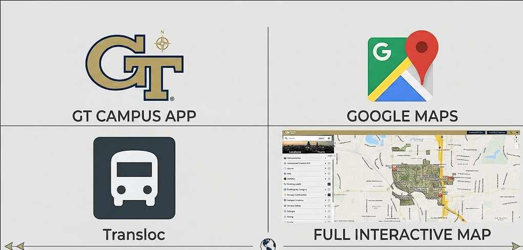
Different navigation tools are useful for different situations. Google Maps can help you find walking/driving routes and estimate travel time. The Transloc app is the official bus tracking app for tracking campus buses and shuttles. The Transloc app can also be used to reserve Stingerette shuttle rides for late night travels. The GT interactive map is useful for finding official building names and specific locations in a more visual manner. Lastly the Georgia Tech app also provide campus resources and student information all in one place. Together, these apps can make a powerful arsenal when you use them for their specific strengths, since each app provides information on a different aspect of campus navigation.
Step 7: Daily Navigation Habits
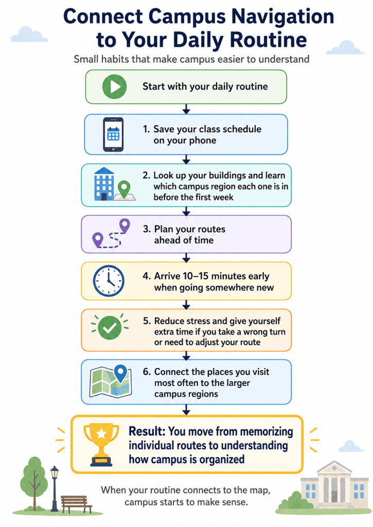
Understanding campus becomes much easier when you connect the map and navigation to your daily routine. Small habits like saving your class schedule on your phone, looking up buildings and their region ahead of time, planning routes, and arriving 10 to 15 minutes earlier help you reduce stress and give yourself extra time if needed. By connecting the areas you visit the most frequently to the larger campus regions, you can move from memorizing individual routes to understanding how campus is organized.


Leave a Reply